Description
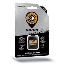
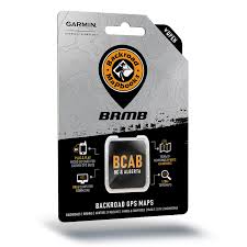
BC and Alberta’s Backroad GPS Maps at a Glance:
- Specifically designed for outdoor recreation enthusiasts
- Get our BC and Alberta Backroad Mapbook brought to life via GPS
- Garmin-licensed & compatible with Garmin GPS and Garmin Basecamp
- Technologically-advanced and user-friendly
- Explore with industry leading cartographic contours and shading
- Provides 3D views and the highest level of map detail available
- Routes extensive road systems including marked and labeled trails
- Search for access points, boat launches, paddling routes and portages
- Thousands of activity and geographic POIs for wildlife viewing
- Marked Wildlife Management Zones for hunting
- Developed in cooperation with local agencies, government, parks, forestry and tourism
Alberta & BC Backcountry GPS Map Features
- 5,000,000+ searchable Alberta Legal Subdivision Sections, Quarter Sections and full LSD grid locations. Includes Quarter Section boundaries.
- 60,000+ KM of improvements to our backroads network.
- New addition of Lake Bathymetry depth contours for 1,950+ fishing lakes, rivers and streams.
- New addition of private leased lands for hunters and anglers.
- New mountain biking and cross-country ski trail networks.
- Close to 8,000 KM of additional paddling routes. Includes 100+ additional paddling routes and access locations.
- 8,000+ KM of additional multi-use, mountain biking, cross-country ski and Trans-Canada Trails. Includes 1,000+ additional trailheads.
- 6,500+ KM of additional motorized trails for ATV-OHVs and Snowmobiles. Includes 225 additional trailheads and staging areas.
- Close to 200 additional fishing lakes, rivers and streams with stocking and species information. Includes 150+ additional boat launches and marinas.
- Close to 200 additional national, provincial and urban parks. Includes 650 additional campsites, day-use/picnic areas, backcountry/canoe campsites, recreation sites and huts in major parks and recreation areas.
- 150+ additional wildlife viewing areas.
- 100+ additional winter recreation activities.
- Garmin GPS™, Basecamp™, MapSource™ and RoadTrip™ compatible
- 1:20,000 / 1:50,000 base scale topographic maps
- Detailed shaded relief for all areas of Alberta & BC
- 3D perspective on select Garmin GPS units and Basecamp™
- The most complete Resource, Industry and Logging road coverage available for Alberta & BC
- Routable City, Resource and Industry Roads
- Tens of thousands of kilometers of trail systems, including defined ATV, Paddling, Snowmobile, Long distance & multi-use trails
- Smart background & Searchable Wildlife Management Units (WMU) for hunters
- National, Provincial and Private Parks & Campsites
- Lake & Stream Fishing information with boat launches
- Searchable Backroad recreation information for fishing, paddling, parks, trails and more
- Boat launches, campsites, paddling access points, ski areas and more
- Find that worksite with Searchable Oil and Gas LSD Grid Locations, PNG Grid Locations, Compressor Stations, Gas Plants, Wellsites and other Resource Facilities
- Tens of thousands of Searchable cities, Geographic Land and Water features


Reviews
There are no reviews yet.